
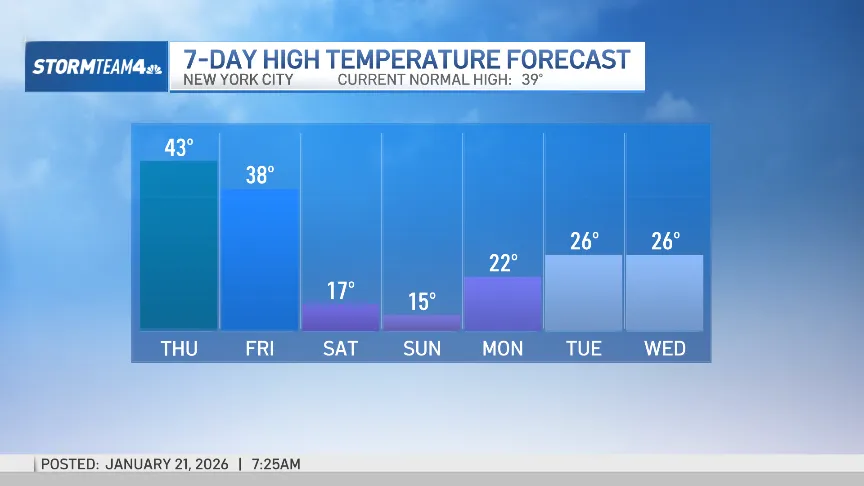
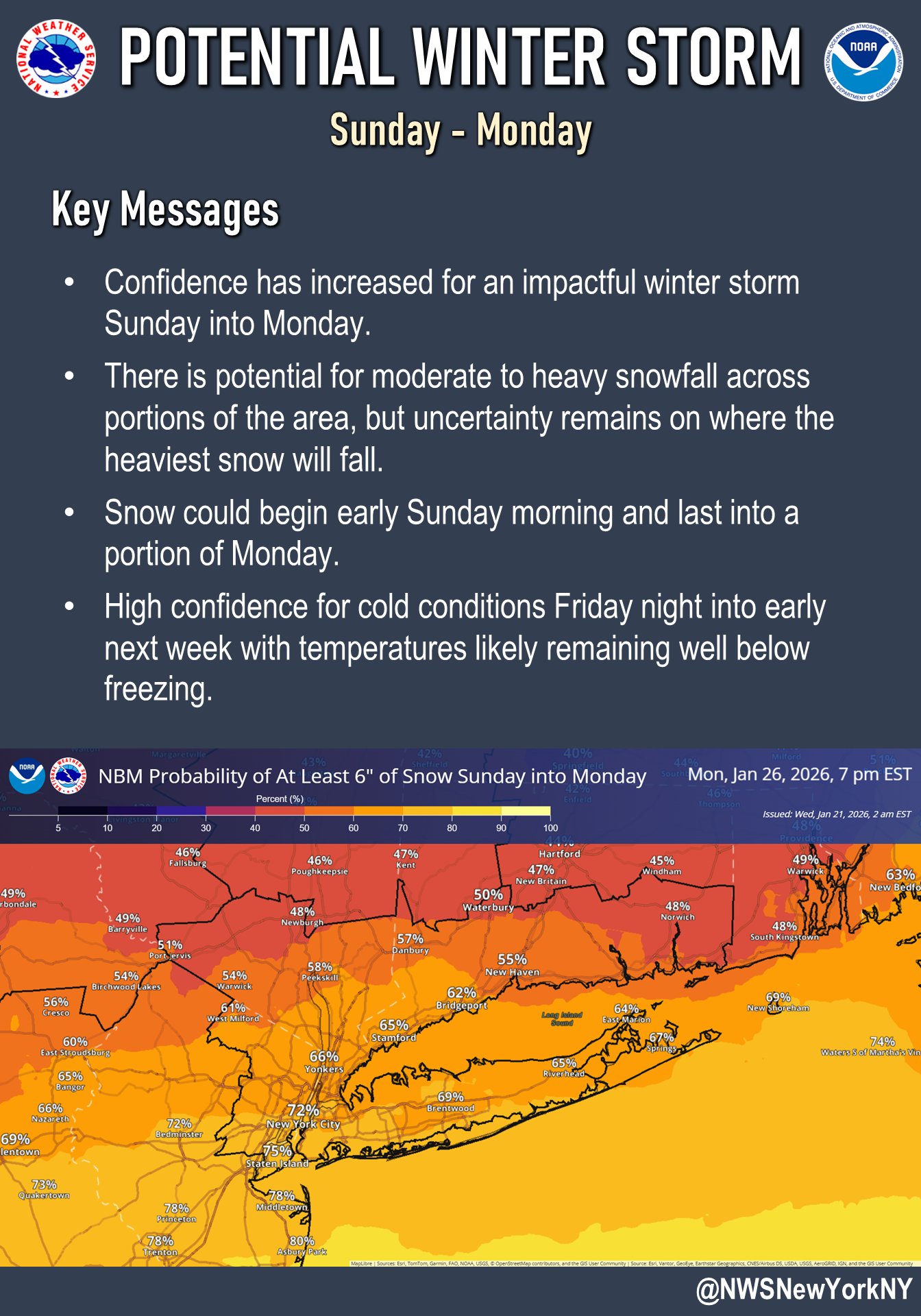
A significant winter storm could bring major snowfall to New York City and the Tri-State Area this weekend, with forecasters warning that more than six inches of snow is increasingly likely � and some models projecting totals well into double digits.
All eyes are now on Saturday and Sunday, both of which have been designated First Alert Weather Days, as a powerful winter system and arctic air mass threaten to collide over the region.
Residents are already dealing with dangerously cold temperatures Wednesday, with a brief break expected Thursday before conditions sharply deteriorate again heading into the weekend.
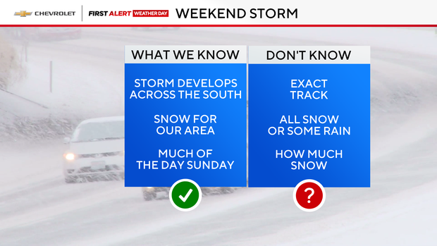
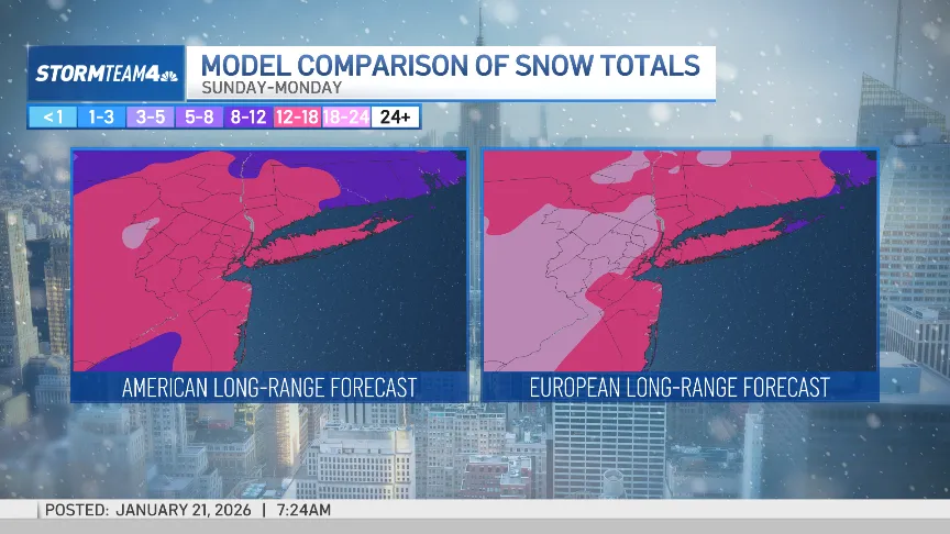
By Saturday night, snow is expected to begin across much of the region. Forecast models differ on exact timing and totals, but both major models point to a potentially significant event.
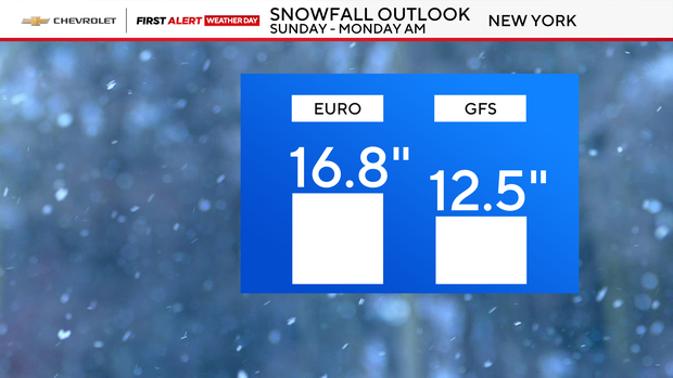
The European model suggests snow could begin earlier, with light to moderate snowfall starting late Saturday night and intensifying into early Sunday. It currently projects as much as 16.8 inches of snow for the region, with arctic pressure centered in central Quebec.
The American GFS model delays the heaviest snow until Sunday morning, but still predicts around 12.5 inches, with arctic pressure centered in central New York State.
Meteorologists caution there is still uncertainty regarding potential mixing, which could limit snow totals, particularly for areas south of NYC. However, forecasters expect the outlook to become clearer in the coming days as the models align.
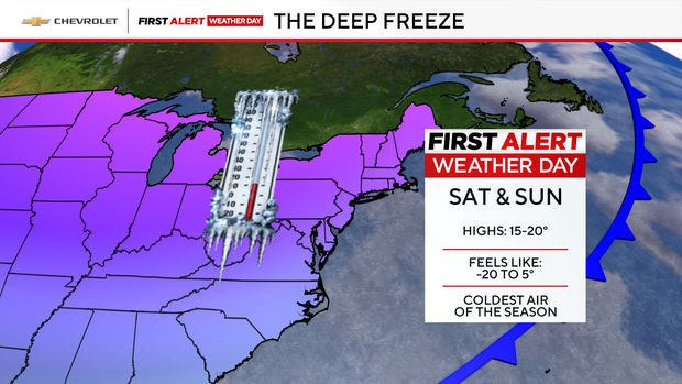
The First Alert Weather Team says confidence is extremely high that an arctic air mass will dominate the Northeast over the weekend, bringing brutal cold alongside the snow.
Saturday will begin with frigid wind chills ranging from �20 to 0 degrees, with afternoon conditions only slightly improving to between �5 and 10 degrees. Sunday will remain bitterly cold, with wind chills in the single digits.
The storm is expected to taper off sometime between Sunday night and Monday morning, but forecasters warn that a messy and hazardous Monday commute is likely.
After the snow exits, an intense blast of arctic air is expected to settle in, plunging temperatures into the teens and low 20s starting Saturday and lingering throughout much of next week.
If current projections hold, this could become one of the most impactful winter events of the season for the NYC metro area.
(YWN World Headquarters – NYC)
 Join the official YWN WhatsApp status


4 Responses
Baltimore/Silver Spring looks like we are getting alot more, they are saying 17-27″ inches!
Snowmaggedon
What does Aaron in 107.9 weather room have to say?
But ???? <<?" ???? ?" ??? doesn't fit the bill this year. for ??? in abundance