
A Winter Storm Warning has been issued for New York City and the Tri-State as a powerful winter storm gets set to spread snow, heavy at times, and dangerous ice in our area for much of Sunday and lingering into early Monday.
Predictions continue to shift slightly as we get neared to Sunday’s snow event. The latest map reflects a change mostly in areas south and west of the city.
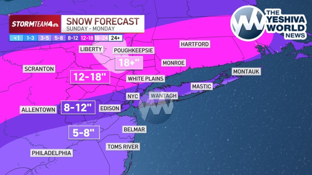
Areas well north and west of New York City could see accumulations of a foot or more of snow, potentially reaching 18 inches, with bullseye regions including northwestern New Jersey, the Hudson Valley and eastern Pennsylvania. The area around the city and Long Island, as well as much of New Jersey, could land in the 8-to-12-inch range.
A Cold Weather Advisory is in effect as a cold front brings the area a blast of frigid temperatures that will last even after the snow falls.
Snow moves in during Sunday morning with the heaviest snow around midday. Sleet and freezing rain could mix in after the initial round of snow during the afternoon. Snow continues through the evening but it won’t be as heavy. Snow will linger into Monday, but it will be light.
Governmental agencies across the Tri-State area are taking the threat seriously and are preparing for a significant storm, as residents stock up on food and supplies in anticipation of one of the biggest winter storms in many years.
 Join the official YWN WhatsApp status


One Response
“Biggest in years” apparently people have zero memory