
A Winter Storm Watch is in effect from Sunday afternoon through early Monday morning for the entire Tri-State region.
The next major system arrives on Sunday afternoon as a mix of snow and rain before changing to all snow at night.
Storm totals look to be in the 3″-6″ range for New York City, but 6″-8″ (Locally 10″) just to the north. Expect lower accumulations south and east of the city, where rain can stay mixed in with the snow for a longer period of time Sunday evening.
The snow will wind down by daybreak on Monday, but expect a very messy Monday morning commute with lots of snow-covered roads.
Meanwhile, much of the tri-state was blanketed with inches of snow Shabbos morning.
The storm dumped more than 5 inches in Bedford Park in the Bronx, more than 4 inches in Midwood (Flatbush), Brooklyn, and nearly 4 inches at LaGuardia, according to the National Weather Service. The highest total in the region was 6.5 inches in Syosset in Nassau County.
Monday
Snow and rain end early. Cloudy, then gradually becoming mostly sunny, with a high near 40. Northwest wind 13 to 15 mph.
Tuesday
Mostly sunny, with a high near 31.
Wednesday
Mostly sunny, with a high near 29.
Thursday
Sunny, with a high near 34.
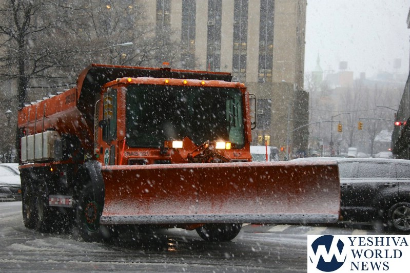
A snow alert has been issued starting tomorrow afternoon and continuing through Monday morning. We are expecting 4-6 inches of snow. Be careful when driving Sunday evening and Monday morning. @NYCSanitation will be ready with salt spreaders and plows. pic.twitter.com/wv65ehFz6E
� NYC Mayor’s Office (@NYCMayorsOffice) March 2, 2019
Here is the latest briefing on the winter storm forecast to impact the area Sunday afternoon into Sunday night!https://t.co/QnALI9qZa3 pic.twitter.com/0pemsxWYUq
� NWS New York NY (@NWSNewYorkNY) March 2, 2019
Winter Storm Watches have been expanded to include the entire tri-state area. 4 to 6 inches of snow is possible from Sunday afternoon into early Monday morning. Plan on slippery road conditions, which could impact the Monday morning commute. pic.twitter.com/efbMatG6ms
� NWS New York NY (@NWSNewYorkNY) March 2, 2019
ACCUWEATHER ALERT: A mix of snow and rain arrives tomorrow afternoon, changing to all snow at night. Here’s the latest thinking on accumulations. Many more details in your full Accuweather Forecast on #abc7ny Eyewitness News at 5. #nyc #nywx #njwx #ctwx pic.twitter.com/SrPyvcoxsq
� Jeff Smith (@JeffSmithABC7) March 2, 2019
ACCUWEATHER ALERT: The next major system arrives tomorrow afternoon as a mix of rain and snow, changing to snow tomorrow night with 3″-6″ for #nyc, but 6″-8″ (locally 10″) just to the north. Clearing Monday and becoming very cold by midweek. #abc7ny pic.twitter.com/P051SBvu9A
� Jeff Smith (@JeffSmithABC7) March 2, 2019
DSNY has issued a Snow Alert for Sunday, March 3, 2019 at
4 p.m. ?? Our snow fighting equipment will be ready for the winter weather coming our way. ?? pic.twitter.com/wbmhE6wsI8� NYC Sanitation (@NYCSanitation) March 2, 2019
(YWN World Headquarters – NYC)
 Join the official YWN WhatsApp status


2 Responses
Parents should still force their children to walk to school. It builds character.
Ahhhh Delicious News like the Good old days ……This Is What YWN Looked Like Years Ago Reporting news