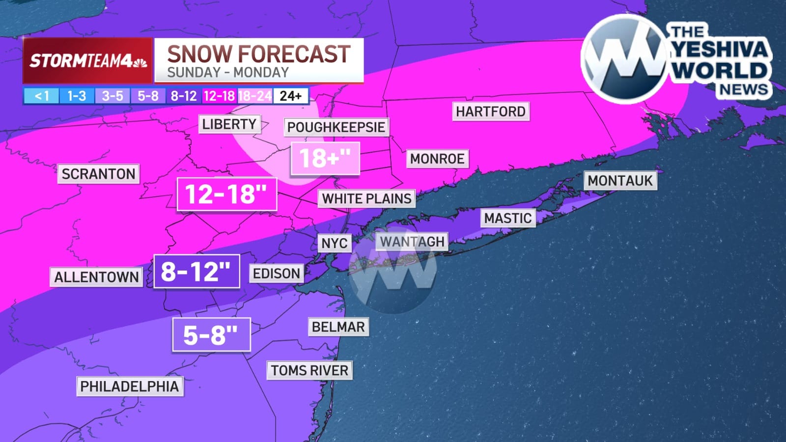
?? THE LATEST SNOW PREDICTIONS FOR THE TRI-STATE AREA: Predictions continue to shift slightly as we get neared to Sunday’s snow event. The latest map reflects a change mostly in areas south and west of the city.
Areas well north and west of New York City could see accumulations of a foot or more of snow, potentially reaching 18 inches, with bullseye regions including northwestern New Jersey, the Hudson Valley and eastern Pennsylvania. The area around the city and Long Island, as well as much of New Jersey, could land in the 8-to-12-inch range.
 Join the official YWN WhatsApp status