
A wintry blast is set to usher in the month of December, with a developing storm on Tuesday expected to bring one of the first substantial snowfalls of the season to parts of the Tri-State area.
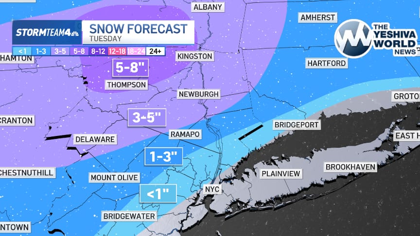
Forecasters say the heaviest accumulations will fall north of New York City, where communities in the mid-Hudson Valley and northwest New Jersey could see five to eight inches of snow. Orange, Putnam, and western Passaic counties are tracking 3 to 5 inches, while much of Connecticut, New Jersey, and the Lower Hudson Valley may see a few tenths of an inch up to 2 inches.
Closer to the coast, impacts are expected to be far more limited. New York City and areas to the south and east will primarily see rain, though forecasters note that a few flakes may mix in as the system arrives early Tuesday morning � just in time to potentially complicate the morning commute.
The storm is expected to clear out by Wednesday. However, temperatures are forecast to hover in the mid-30s in Wednesday night.
Along the immediate coastline, including NYC, little to no accumulation is expected.
(YWN World Headquarters � NYC)
 Join the official YWN WhatsApp status


