
A high-impact winter storm is poised to slam the tri-state area late Friday, threatening to snarl travel and test emergency preparedness across one of the nation’s most densely populated regions.
Forecasters say a strengthening area of low pressure will approach the region late Friday afternoon, spreading accumulating snow from southern Connecticut through New York City, Long Island, northeast New Jersey and into the Hudson Valley.
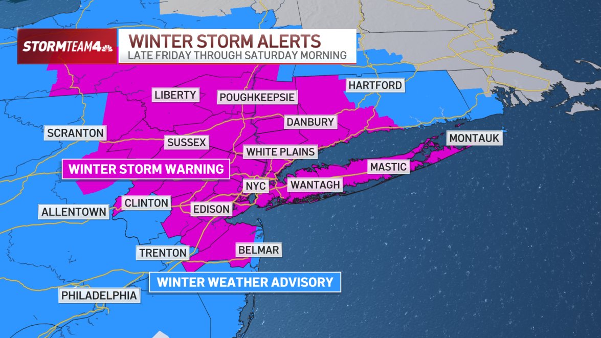
A winter storm warning is in effect from 4 p.m. Friday through 1 p.m. Saturday for the entire metro area, signaling confidence among meteorologists that the system will deliver disruptive conditions.
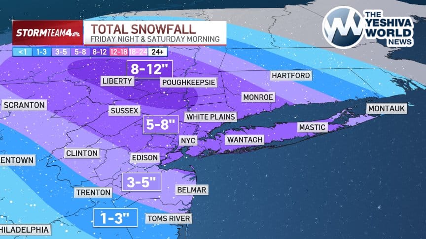
Current models project as much as 6 to 8 inches of snow for New York City, Long Island and central New Jersey, with higher totals possible in parts of North Jersey and the Hudson Valley.
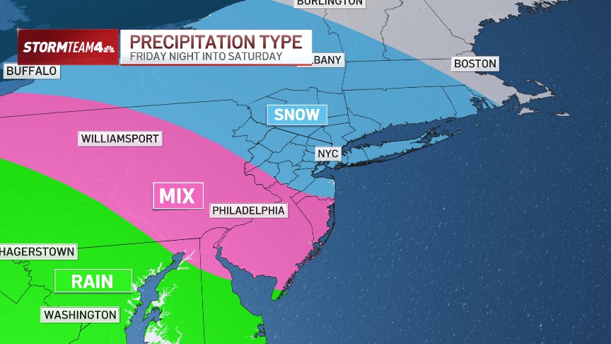
For much of New York, Connecticut and northern and central New Jersey, the storm is expected to fall entirely as snow, with temperatures remaining below freezing throughout the event. Areas farther southwest are likely to see a more complex mix of snow, sleet, freezing rain and rain.
Even modest snowfall could have outsized impacts. Central Park has not seen a 4-inch snowfall since January 2022, after several historically light snow seasons. If forecasts hold, this storm would mark the city’s most significant snow event in nearly four years.
Snow could begin falling as early as 6 p.m. Friday, but forecasters say conditions will deteriorate rapidly overnight. The heaviest snowfall is expected between midnight and 6 a.m. Shabbos morning.
The New York City Emergency Management Department has issued a travel advisory for Friday evening through Saturday, urging residents to expect delays and hazardous conditions. Officials warned that even thin ice accumulation in areas seeing a wintry mix could make roads especially dangerous.
Transportation agencies across the region are preparing for potential disruptions, with officials closely monitoring road conditions, transit operations and airport schedules as millions return from holiday trips.
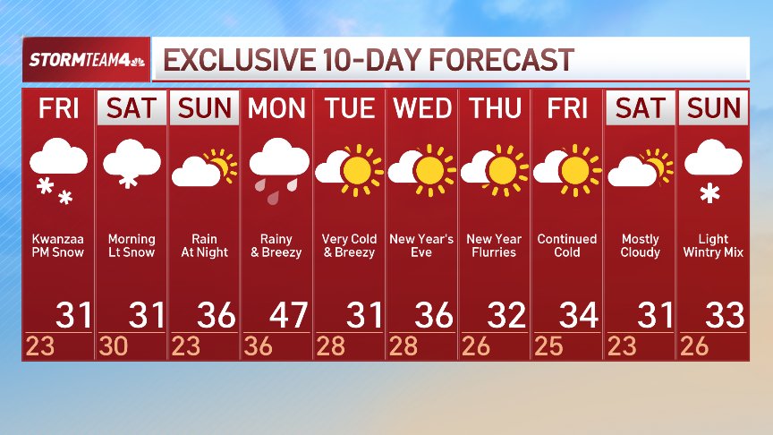
A second system, arriving Sunday night, is expected to bring warmer temperatures and all rain. That rainfall could melt newly fallen snow and lead to isolated flooding and renewed travel headaches into Monday.
After that system exits, forecasters say a surge of colder air will move in as the region closes out 2025 and heads into the new year.
(YWN World Headquarters – NYC)
 Join the official YWN WhatsApp status


2 Responses
Snowmaggedon! ?
More like dudmaggedon ???