A powerful “bomb cyclone” winter storm is taking shape over the Atlantic and is on track to slam into the New York City metro area this weekend, threatening fresh snowfall, punishing winds and dangerous wind chills for a region still digging out from last weekend’s historic storm.
Forecasters say the rapidly intensifying system is expected to arrive Saturday night and linger through Sunday, potentially dumping up to 3 inches of additional snow across the city and surrounding suburbs.
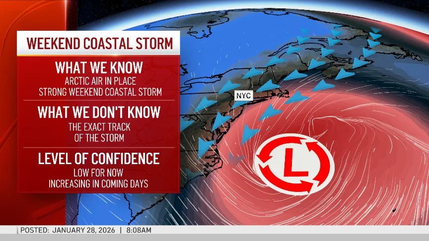
A bomb cyclone — formally known as bombogenesis — occurs when a winter storm rapidly strengthens, typically over ocean waters, as atmospheric pressure drops at an extreme rate. These systems are known for producing intense snowfall, gale-force winds and life-threatening cold.
Meteorologists are warning that the most dangerous element of this storm may be the wind.
With temperatures already hovering between 14 and 24 degrees, strong winds are expected to drive wind chills into the single digits — and in some areas, even below zero, according to AccuWeather.
“Regardless of the storm track, it will likely be a blustery day on Sunday, especially from the city on east and south,” AccuWeather senior meteorologist Matt Benz said. “Here in the City, snow can lead to slippery roads for Sunday. Unless there is a major shift in the storm track to the west, we don’t expect travel conditions to be as dangerous as they were compared to last weekend here in the City.”
While city impacts may be somewhat limited compared to last week’s deadly Winter Storm Fern, forecasters say conditions could be significantly worse east of the city.
Long Island is expected to take a harder hit, with as much as 6 inches of snow possible. Meteorologists warn that white-out conditions could overtake both the North Fork and South Fork, raising the risk of dangerous travel and localized blizzard conditions.
The storm is expected to weaken and move out by Sunday night. However, the cold will remain entrenched well into next week. Temperatures are forecast to stay below freezing for days, with the freezing mark only expected to be briefly broken by a single degree next Thursday.
(YWN World Headquarters – NYC)
 Join the official YWN WhatsApp status