
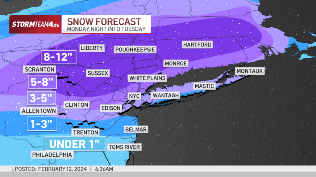
An approaching winter storm has the potential to deliver up to a foot of snow for some across the tri-state Monday night into Tuesday, and projected totals are rising for the New York City area.
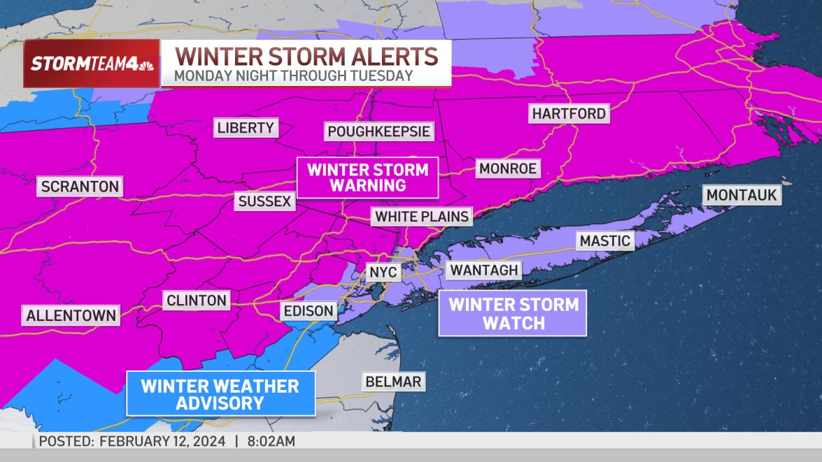
Snow totals could reach 6 to 12 inches north of the city, into northwestern New Jersey and the Hudson Valley. The National Weather Service issued a winter storm warning for a swath of the region. New York City is under a winter weather watch, along with Long Island.
New York City schools will go fully remote Tuesday in anticipation of the storm, Mayor Eric Adams announced.
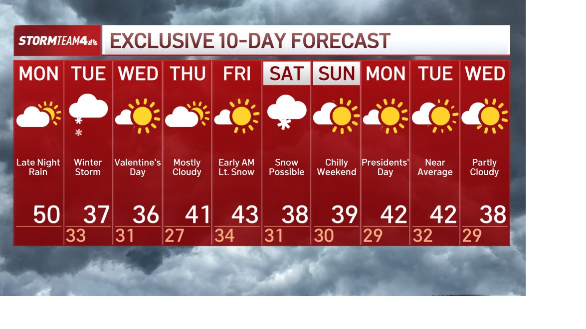
Expect a dry Monday ahead of the storm, which moves in late at night.
Precipitation will begin late Monday. The storm will bring a period of moderate to heavy snow, and rain transitioning to a rain/snow mix and then snow down the coast.
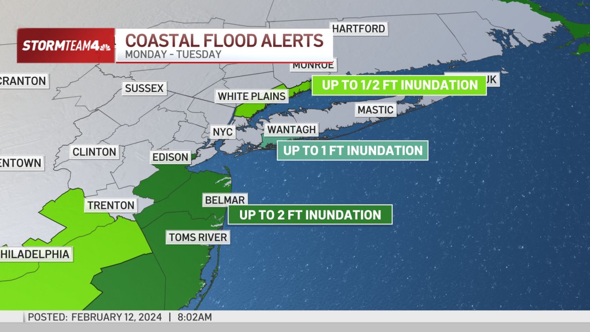
Gusty winds and minor to moderate coastal flooding impacts are possible.
The Tuesday morning commute could be significantly affected by the storm and its impacts. Snowfall rates could hit 1 to 2 inches an hour during the AM rush along the I-95 corridor from Philadelphia to Boston. They could be even higher across eastern Pennsylvania, northern New Jersey and the Hudson Valley.
The snow is expected to taper off before the evening rush, but lingering impacts are likely.
NBC Storm Team 4 is currently forecasting 3 to 5 inches of snow for New York City and Long Island.
The Hudson Valley and interior areas of New Jersey, Pennsylvania, and Connecticut are likely to get heavier amounts. High-end snow totals could reach 8 to 12 inches at higher elevations.

(Source: NBC New York)
 Join the official YWN WhatsApp status


