
With only a few official weeks of winter left, an approaching storm could finally bring New York City some accumulating snowfall.
A Winter Weather Advisory is in effect through Tuesday morning for New York City and coastal areas. A Winter Storm Warning is in effect north and west of New York City. The high temperature will be 41 in New York City, and in the low 40s in the suburbs.
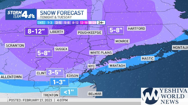
Rain and snow will be developing during the evening. New York City and northern New Jersey could see snow and sleet accumulation of 3 to 5 inches, according to the National Weather Service. Long Island could get between 2 and 4 inches of snow.
Lakewood will see mostly rain with possibly some sleet.
The Catskills, including the Monsey area, will be the big winner (or looser) with expected accumulation being in the 5-8 inch range, with Monsey being on the lower end.
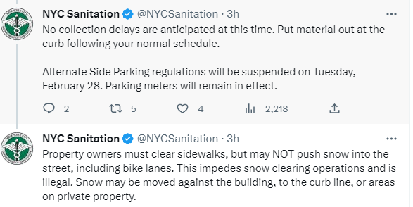
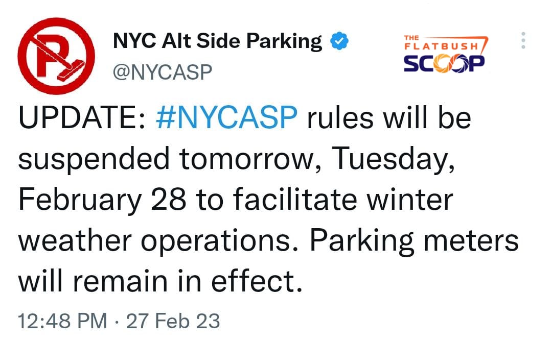
The NYC Emergency Management Department issued a travel advisory following the National Weather Service Winter Weather Advisory. As of the latest forecast, light snow is expected in the area beginning around 6:00 PM tonight with heavier and steadier snowfall between 8:00 PM and midnight. During that time snowfall rates of an inch per hour are possible. Snow is expected to transition to a mix of snow, sleet, and rain after midnight. These conditions may continue through the morning commute and cause hazardous travel and transportation disruptions. A total accumulation of 2 to 4 inches of snow is forecast, with upwards of 5 inches possible in the Bronx and Northern Manhattan. Wind gusts of 30-35 mph are also expected late tonight through mid-morning tomorrow. If you must travel, we encourage the use of mass transit.
(YWN World Headquarters – NYC)
 Join the official YWN WhatsApp status


2 Responses
Snow in Hebrew is ??????
Global warming.